Recognizing the excelence in the telecom sector. Discover the Crowdsourced Awards


For Planning Department
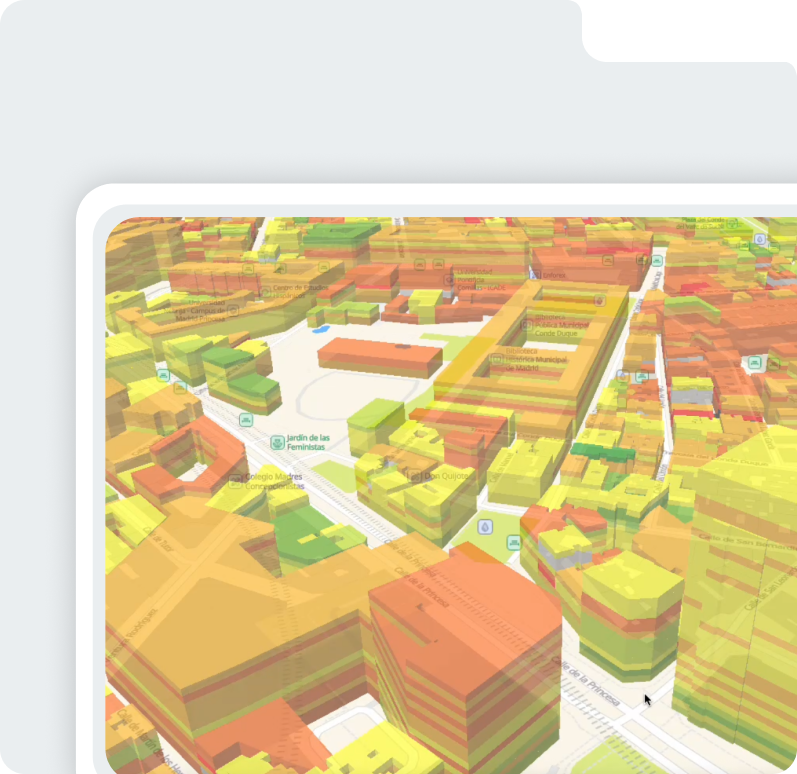
Visualize network performance with detailed geographic insights.
Turn geospatial data into competitive advantage
Detect coverage gaps and densification needs. Benchmark competitor deployments visually. Identify building-level improvement opportunities.
Explore KPIs spatially for smarter RF planning
View KPIs (RF, WiFi, latency, traffic, etc.) in flexible geographic formats. Analyze network conditions at any scale: from city blocks to individual buildings. Deep analysis and strategic decisions down to street or building level.


Proud member of: